THE SIGNIFICANCE OF GIS DATA IN VACCINATION DRIVE

COVID19 is still stalking the world and the urban poor residing in informal settlements are struggling to get vaccinated. There are various misconceptions and myths regarding COVID19,and hence there is a pressing need for widespread awareness campaigns to dispel these fears. There is a paucity of information related to vaccination processes which has resulted in low vaccine coverage in slum communities. As a result, it is often assumed that residents in informal settlements are reluctant to receive vaccinations. More than 75% of individuals living in the slums of Pune, Kolhapur, Thane and Navi Mumbai who are above 18 years old are eager to get vaccinated, according to Shelter Associates’ household level survey results. However, vaccination coverage is low. The stumbling block is the online registration process and vaccine availability. In Maharashtra only 30% of the population is vaccinated for the first dose and only 1/3rd of them is vaccinated with the second dose. The lack of adherence to Covid Appropriate Behavior(CAB) guidelines, combined with a lower level of vaccination coverage, are key contributors to the rise of COVID-19 infection in the state. Our focus should be on an effective community-based behavioral change strategy that clears up any vaccination misunderstandings and facilitates online registrations along with community vaccination camps, as well as promoting CAB.
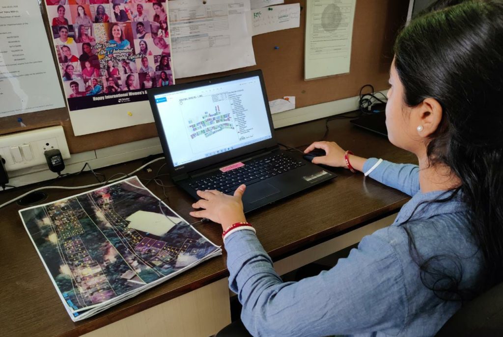
In house GIS Analyst working on informal settlement

Shelter Associates’ In-house GIS Data and field teams play a very important role in driving the vaccination process. The process followed by the team are as below:

  • The team of GIS Analysts map the selected slums of the 4 cities of Maharashtra with the help of a GIS based software. 
  • Plus Codes (Digital addresses codes) are generated for each house 
  • On-field community workers at Shelter Associates physically visit each and every slum house and collect raw data through household surveys covering the vaccination details and the families interested for vaccination
  • After this process, the data is integrated on a GIS platform and spatially queried. .

The spatial maps generated by the GIS team include details of the number of people who have completed their vaccinations and those who are left behind. Accordingly, detailed planning is done to drive the vaccination camp. Shelter Associates plan on how things can be taken forward to drive the vaccination process smoothly. To register the unregistered for the first dose of vaccine, volunteers residing in slum communities are trained so that none of them are missed out and all get vaccinated. 

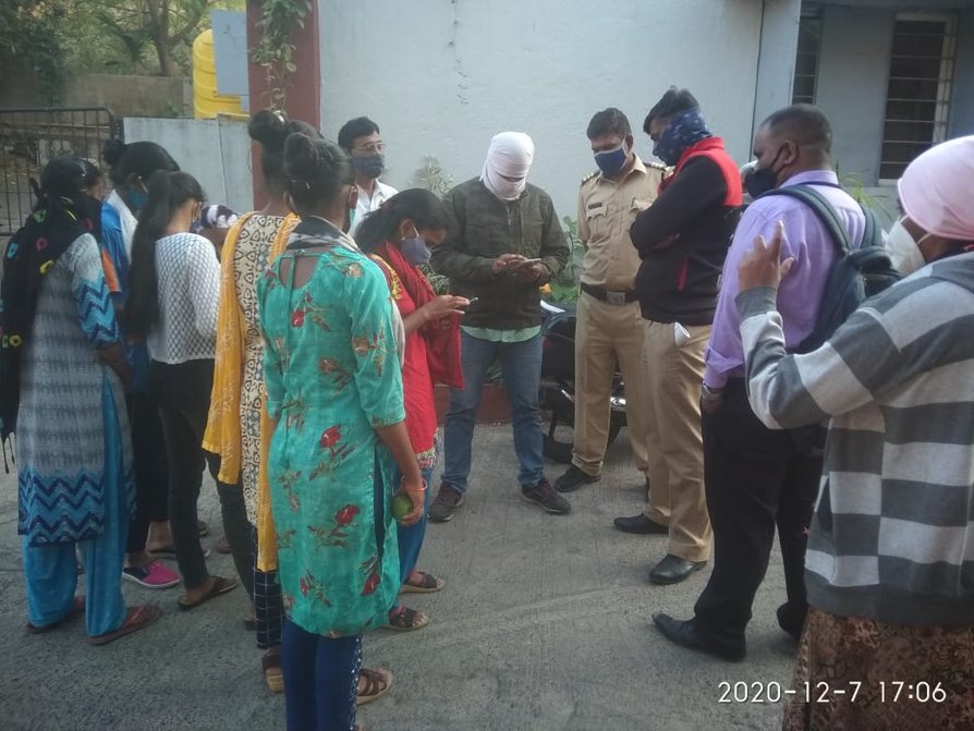
Vaccination Tokens are been distributed

Once the slum pocket gets finalised, the community co-ordinators at Shelter Associates distribute tokens to the registered individuals. These tokens are then presented at the time of Vaccination Camps for a smooth implementation of the vaccination process. Upon further cross-verification, the pre-registered and spot registered individuals are inoculated by the health officers present during the camp.

Till September 2021, Shelter Associates helped more than 4431 people get vaccinated in Pune and Kolhapur through 16 and 9 vaccination camps respectively. Shelter Associates is making full efforts to raise awareness around the importance of vaccination  through a rigorous process of primary surveys and data collation, mobilizing the community people and setting up vaccination camps.

Spatial Map of Ganjimal Settlement (Kolhapur) post vaccination

This map is created through spatial data, post vaccination of Ganjimal Settlement of Kolhapur Municipal Corporation. Shelter Associates is rigorously  working on the other slums to cater the needy and help them get vaccinated through ground level survey and setting up vaccination camps.

SLUM HOUSEHOLDS GET THEIR INDEPENDENT DIGITAL ADDRESS THROUGH PLUS CODES

Having an independent accessible address means so much more than just having a place of living. As per 2014 World Bank Data, 24% families in India live in slums who are often packed into overcrowded homes and cramped living conditions. They either don’t have an address or have one that does not identify their house or business location accurately.  Therefore, for basic facilities and emergency services to reach their doorsteps, a navigable location address is a must in the present digital era and this is where Shelter Associates has partnered with Google and UNICEF to bring this unique and powerful solution known as Plus Codes to the have-nots of the city.

Steps to search location using Plus Code

Steps to search location using Plus Code

Plus Codes use latitude and longitude to produce a short, easy-to-share alpha-numeric digital address that can represent any location on earth. Whether you want to open a bank account, secure confidential letters or simply order food online, all you have to do is enter your unique Plus Code on google maps and get navigated to your doorsteps. Number plates with the plus code can be fixed on the doors of individual huts for ready reference of the unique address. Plus Codes also directs individuals or service providers to the nearest amenities such as water standposts, electrical posts, community Toilets, manholes, etc.

Closer view of Plus Code on slum maps

Closer view of Plus Code on a slum map

Shelter Associates strategises its preliminary Plus Code project in the slum settlements of Pune, Thane, Kolhapur and Navi Mumbai.

Slum dwellers receive an independent identity through this addressing solution for easy accessibility of services such as water, sanitation, healthcare, electricity, opening bank accounts, postal services, etc further saving time and guiding service providers to reach individual doorsteps. Also, emergency services such as Fire, Ambulance and Police can find them during an emergency.

Plus Code demonstration to communities

Plus Code demonstration to communities

The slum communities are also mobilised by Shelter Associates’ community workers through awareness workshops and personal meetings to understand the concept of plus codes and use it to their advantage. Large slum maps displaying household and infrastructure plus codes are also been installed in the slums for easy accessibility.

Slum residents of Laxmi Nagar reading the map

Slum residents of Laxmi Nagar reading the map

The plus code project is not limited to communities only but has also been playing an instrumental role for effective e-governance. Lack of granular data has always hampered governments from reaching out to the vulnerable families but through this initiative, the Urban Local Bodies will link this new data to their existing data through which they can access and update more precisely. They will be able to spatially pinpoint and analyze their database and use the same for effective and efficient service delivery which is also beneficial during Pandemics for facilitating the provision of emergency and essential services. Humanitarian groups, NGOs and Urban Local Bodies can easily find people needing basic aid along with tracking and monitoring programs related to health, education, etc.

Plus Code plate installed at the beneficiary's home entrance

Plus Code plate installed at the beneficiary’s home entrance

Refer to the Plus Code Film  for more information on Plus codes and its impact

Sharing the Knowledge of Data Technology

Why is data and technology important? Is it better to make planned interventions with the presence of updated data? The answer however is a definite YES as more in-depth information is useful for better policy-making or effective service delivery for any government, non-government as well as private organization.

Analyzing gathered data can determine gaps in delivery of services, improve policies and make budgetary provisions while allowing governments to boost their economy faster and in a sustainable manner.

Shelter Associates, a non-profit organisation facilitating improved sanitation and housing for the urban poor of Maharashtra, pioneered the use of Geographic Information System (GIS) technology & Google Earth for poverty mapping in late 90’s. Holistic spatial data was created by mapping settlement patterns and infrastructure in and around slums. These GIS Maps help ensure that the requisite infrastructure (sewage pipes or septic tanks) and toilets are provided in the right location, keeping in mind topography, road access conditions, family characteristics and neighborhood. The mapping is supplemented with survey data collected at the household level and analyzed to identify the most vulnerable population and plan targeted interventions.

Pratima Joshi highlighting on the importance of data mapping

Pratima Joshi highlighting on the importance of data mapping

Data experts at Shelter Associates share spatial data knowledge through a workshop with Sanitary Inspectors and Engineers at various Municipal Corporations of cities where the ‘One Home One Toilet’ sanitation model is put to practice.

The main aim of the training workshop is to (a) make the Urban Local Bodies understand the use of data effectively in day-to-day activities (b) minimize potential gaps in service delivery in the fields of sanitation, education, health, etc. (c) train the officials to read and use spatial maps for other service delivery.

Data training held at Thane Municipal Corporation

Data training held at Thane Municipal Corporation

Shelter Associates foster strategic partnerships with the Urban Local Bodies in the cities where they operate and as a part of this inclusive approach, the data knowledge is shared within the city municipal corporation who could carry out more micro-level interventions without having to rely on inadequate secondary data. By the end of the training workshop, they can read the maps generated by SA, toggle the different data parameters provided, and get a sense of how to leverage the data for better community development.

Making the complex: simple – Kobo Toolbox improves efficiency in data collection

Recording data on TabletShelter Associates (SA) has been providing housing and sanitation to the urban poor fr over 23 years. Since 2010, individual sanitation has been delivered in a structured and focused manner in vulnerable slums. The process of facilitating household toilets was initiated with extensive data collection and analysis at each stage. The collected data formed the foundation of a pragmatic approach, ensuring feasibility of interventions, as well as an efficient and optimum use of funds. The data collection is carried out with help of the following surveys:

  • Rapid Infrastructure Mapping – mapping of existing infrastructure of slum
  • Rapid Infrastructure factsheet – profiling of slum
  • Rapid Household Surveys – collecting household level data
  • Individual factsheet – for maintaining record of completed toilets

SA used a web-based application for data entry and creating reports (using collected data) and an android app for data collection of the above mentioned surveys. Data collection is an ongoing process. With the expansion of our operations in new cities, the survey forms and data collection systems need a continuous update. It was possible to modify the existing platform too, but very little. SA and its IT partner Soft-Corner were thus exploring new ways to incorporate the requirement. Meanwhile, Mr. Donald Lobo suggested an open source platform called Kobo Toolbox for defining and deploying surveys and for collecting data.
KoboToolbox, a set of open source software tools, seemed quite suitable for our requirements. Soft-Corner also verified it by running a few tests on it for the same. SA has started its work in a new city recently – Navi Mumbai – where Kobo Toolbox is being used for data collection and entry. We have found it pretty user friendly and time saving while also allowing customization. Our initial experience in using this new tool was very good.

  • Benefits at a glance
    Mobile application
    The survey can be deployed on mobile devices very easily
    The entered data can be edited
    The earlier app allowed uploading of responses one at a time. This allows all at one go (or one or multiple by choosing which ones to upload)
    Web application
    A lot of options in the definition of different types of questions – including validation rules and skip patterns, save time on the field and increase the accuracy of the data collected.
    Grouping questions enable us to view them on a single page.
    Repetition of a set of questions is possible, based on a value (for example – if there are 3 community toilets, then the same set of questions about the community toilets are asked 3 times – once for each community toilet)
    Data can be viewed and edited in code or label format
    Data downloading in various formats is possible.We can also view and download photos captured using the mobile app
    Data analysis is made easier
  • Challenges
    Here is a wish list of what more we would have liked
    1. We cannot add a question to the existing form and if we do, we have to redeploy it and redeployment means losing existing data.
    2. As far as our understanding, there is no provision of having long integer data type
    Skip patterns cannot be given based on the values of certain options of a question
    3. The exported excel needs formatting. (-).
    4. There seems to be no provision to auto copy a field from the previous response – like the slum name. If we have to enter 50 responses, each time we have to enter the slum name.)
    5. There seems to be no provision for re-edits from the mobile device after uploading the data to the server. This could potentially lead to a problem. For example – if we have uploaded the data of household number 23 (improperly) and at some later date, I enter the correct 23, we cannot edit the previously uploaded data from the mobile device. we have to do it from the web module.
    6. When a response is entered on the mobile device for a survey form, it asks for a name by which it would save the response on the mobile device. However, there is no format or validation rule that can be given for this name – which essentially means that each data person collecting the data can give the name of their choice. It would be more organized if we could give a pattern to force the naming in a certain way. Or alternatively, if we can pick some field(s) from the current response (like household number and the status) and show that as the default name to save the response, it would be very convenient.
    7. The above mentioned name (by which the response is saved on the mobile device) is not available eventually – both at the back end and in the exported data. Its use is only till we upload the data. If that name is available for the record that could help.

Mobile App slum data entry trials begin

On 16th August 2013 Shelter Associates commence trials of the Shelter Associates survey mobile application.  Shelter Associates community workers took a tablet computer into the slums and tested the system of uploading slum data direct to the Shelter Associates on-line data collection system.

Shelter Associates have created city profiles for Pune and Sangli & Miraj which are hosted on the Shelter Associates website and are maintaned and updated by Shelter Associates on a regular basis.  Each city profile contains information for all slums within the municipal area including: the land ownership, development plan reservations, development plan zoning proposals, approximate area, population, location, topography, in addition to detailed data regarding services such as toilets, water, solid waste management, drainage and roads and access.  The information is freely available for everyone including city administrations.

To support the on-line city profiles, the NGO has developed an on-line survey system where all collected data can be input, and recently Shelter Associates has developed a mobile application which allows data to be uploaded to the on-line survey system by a surveyor with a smart phone in a slum, ward office, or any other location.

Google Earth satellite passes over the IHSDP

In early March this year a Google Earth satellite passed over Sangli & Miraj, the urban area in Maharashtra where Shelter Associates are implementing the Integrated Housing and Slum Development Program (IHSDP) under the Government of India’s Jawaharlal Nehru National Urban Renewal Mission (JNNURM).  The resulting satellite photographs, which can be viewed on the Google’s application Google Earth, provides a unique aerial perspective of the construction sites where the site layout can clearly be seen.  The software also records the history of the IHSDP in this area as the historical imagery function on Google Earth allows earlier satellite photographs to be viewed, photographs taken prior to the construction of the new houses when the area was a slum.

Viewing the satellite photographs before and during construction of the new site layout poignantly illustrate the benefits of the new layout: (1) the access for the emergency services will be easier, (2) the capacity of the site has increased (in the case of Sanjay Nagar – from 311 slum huts to 434 apartments) allowing slum communities from nearby slums which either cannot be developed or flood to relocate here in walk up tenements which are G+3, (3) all of the buildings are organised around a central semi-public open space, (4) all of the apartments are organised around a semi-private courtyard, a strategy which allows natural light and natural ventilation to be maximised and minimises the requirement for (expense of) artificial lighting and ventilation, (5) the new buildings are capped with accessible terraces which can be used for a variety of community purposes such as a quiet place for children of the community to study.

Shelter Associates is the winner of the Dasra Giving Circle 2013 (Urban Sanitation)

Shelter Associates has been chosen from among 160 NGO’s across India as the winner of the Dasra Giving Circle grant for supporting a city-wide urban sanitation program in Pune over the next 3 years.

Dasra, India’s leading strategic philanthropy foundation, undertook a process to determine which NGO’s in India are doing work which: (1) has a direct impact on urban sanitation, (2) has the ability to reach high volunmes, (3) has links with the government, and (4) has a sanitation model which is scaleable.  Dasra researched over 160 NGO’s and identified 15 organisations for visiting.   Dasra came to Shelter Associates Pune office to meet with the Executive Director and the Shelter Associates team to learn about the history, philosophy, working methodology of the NGO.  Site visits were also conducted so that the Dasra representatives could interact with Shelter Associates project beneficiaries to witness impact on the ground.  Of the 15 organisations visited 9 were determined by Dasra as being organisations which could deliver high quality at scale.  The 9 organisation were then whitled down through an internal process within the Dasra team to identify 3 organisation who would be invited to present to the Dasra Giving Circle (DGC), a group of 15 philanthropic individuals who all pledge an equal amount into a collective pool which is awarded to 1 of the 3 presenting organisations.  Shelter Associates gave a presentation to the DGC which focussed on the evolution of the organisations model for providing individual sanitation in the urban and peri-urban slums and described how the individual sanitation model would be scaled up to cover Pune in a city-wide slum sanitation project.  The 15 DGC members cast their votes which resulted in a Shelter Associates victory.

For more information please click the following link:

http://www.dasra.org/toilets-and-Sanitation-2013

Le Monde covers the IHSDP in Sangli & Miraj

On 22nd March 2012 Le Monde, a leading French newspaper, published an article and an infographe (photo story) of the Integrated Housing and Slum Development Program (IHSDP) in Sangli and Miraj.

Links to the article and photo story are below:

Original Le Monde article (French)

http://www.lemonde.fr/planete/article/2012/03/22/en-inde-google-earth-se…

Le Monde infographe (French)

http://www.lemonde.fr/planete/infographe/2012/03/22/a-sangli-du-bidonvil…

Wordcrunch translation into English (dated 28th March 2012)

http://www.worldcrunch.com/google-earth-india-can-no-longer-hide-its-sha…

Times World (dated 28th March 2012)

http://www.time.com/time/world/article/0,8599,2110387,00.html


Lake Innovation Conference

Pratima Joshi, Executive Director of Shelter Associates, recently participated in a social media technologies workshop through the Ashoka Foundation. Identified as having used web 2.0 and/or social media technologies to advance SA’s work, she was invited to the Rockefeller Foundation’s Bellagio Study Center in Northern Italy. The purpose of the workshop was to determine how an NGO can best use social media tools to transform their work and generate ideas and solutions to specific problems. Innovative social change work can be accelerate with the use of innovative communications technologies.

Watch this short film showing the Ashoka Fellows and workshop administrators who attended:

Shelter Associates is a ‘Google Earth Hero’

Google Earth has featured Shelter Associate’s work under the Heroes of Google Earth campaign.  Shelter Associates was chosen for it’s innovative use of Google Earth as a urban planning and development tool to help the urban poor gain access to housing and essential services (water and sanitation).
Shelter Associates is the only organisation in India to be named as a ‘Google Earth Hero’ and shares the accolade with only 8 other organiations internationally.
A short (3 minute) film has been made by Google to explain Shelter Associates use of Google Earth and is viewable via the Google Earth web page:
IHSDP from above: